本页部分内容以其撰写时的语言显示,因为翻译尚未完成。
要点
- 将 GPS 坐标写入现有的图像文件中。
- 将照片时间戳与单独记录的轨迹日志进行匹配。
- 消除了对带有集成 GPS 接收器的相机的需求。
- 在 Linux 上运行。
- 在 GPL-2.0-or-later 下分发。
关于此应用
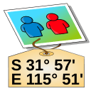
GPS Correlate adds geographic coordinates to photographs after they have been taken. Rather than depending on a camera with a built-in receiver, it compares the time recorded for each image against a track log captured by a separate GPS device, then writes the matching position into the image metadata.
The process assumes two inputs: pictures carrying usable timestamps, and a track log that covers the same span of time. When a photo falls between two logged points, the position has to be worked out from the surrounding record, so the outcome depends on how densely the track was sampled and on the camera clock agreeing with the receiver's time. Once the coordinates are written, they stay with the file and can be read later by image viewers, cataloguing software, and mapping tools.
The program is published by Daniel Fandrich under the GPL-2.0-or-later licence and is packaged for Linux, so it fits photo workflows on that platform and not on others.
获取途径
Linux
- 在 Flathub 上打开在新标签页中打开软件包仓库Flathub
来自发布者
在终端中安装
flatpak install flathub io.github.dfandrich.gpscorrelate
我们不托管该文件,不扫描该文件,也不检查其内容。请阅读来源的说明,然后自行判断。