Certaines parties de cette page apparaissent dans la langue dans laquelle elles ont été écrites, car la traduction n'est pas terminée.
Points clés
- Écrit des coordonnées GPS dans des fichiers d'images existants.
- Met en correspondance les horodatages des photos avec un journal de trace enregistré séparément.
- Supprime le besoin d'un appareil photo doté d'un récepteur GPS intégré.
- Fonctionne sous Linux.
- Distribué sous GPL-2.0-or-later.
À propos de cette application
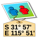
GPS Correlate adds geographic coordinates to photographs after they have been taken. Rather than depending on a camera with a built-in receiver, it compares the time recorded for each image against a track log captured by a separate GPS device, then writes the matching position into the image metadata.
The process assumes two inputs: pictures carrying usable timestamps, and a track log that covers the same span of time. When a photo falls between two logged points, the position has to be worked out from the surrounding record, so the outcome depends on how densely the track was sampled and on the camera clock agreeing with the receiver's time. Once the coordinates are written, they stay with the file and can be read later by image viewers, cataloguing software, and mapping tools.
The program is published by Daniel Fandrich under the GPL-2.0-or-later licence and is packaged for Linux, so it fits photo workflows on that platform and not on others.
Où l’obtenir
Linux
- Ouvrir sur FlathubOuvre un nouvel ongletDépôt de paquetsFlathub
De l’éditeur
Installer depuis un terminal
flatpak install flathub io.github.dfandrich.gpscorrelate
Nous n’hébergeons pas ce fichier, nous ne l’analysons pas et nous n’en inspectons pas le contenu. Lisez ce qu’en dit la source, puis décidez par vous-même.