翻訳が未完了のため、このページの一部は書かれた言語のまま表示されています。
主な特徴
- 既存の画像ファイルにGPS座標を書き込む。
- 写真のタイムスタンプと個別に記録されたトラックログを照合する。
- 内蔵GPS受光器を備えたカメラの必要性をなくす。
- Linux上で動作する。
- GPL-2.0-or-laterのもとで配布されている。
このアプリケーションについて
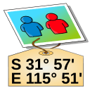
GPS Correlate adds geographic coordinates to photographs after they have been taken. Rather than depending on a camera with a built-in receiver, it compares the time recorded for each image against a track log captured by a separate GPS device, then writes the matching position into the image metadata.
The process assumes two inputs: pictures carrying usable timestamps, and a track log that covers the same span of time. When a photo falls between two logged points, the position has to be worked out from the surrounding record, so the outcome depends on how densely the track was sampled and on the camera clock agreeing with the receiver's time. Once the coordinates are written, they stay with the file and can be read later by image viewers, cataloguing software, and mapping tools.
The program is published by Daniel Fandrich under the GPL-2.0-or-later licence and is packaged for Linux, so it fits photo workflows on that platform and not on others.
入手先
Linux
- Flathub で開く新しいタブで開きますパッケージリポジトリFlathub
発行元から
ターミナルからインストール
flatpak install flathub io.github.dfandrich.gpscorrelate
当サイトはこのファイルをホストしておらず、スキャンも内容の確認も行いません。出典の記載を読み、ご自身で判断してください。