Một số phần của trang này đang hiển thị bằng ngôn ngữ gốc, vì bản dịch chưa hoàn tất.
Điểm nổi bật
- Ghi tọa độ GPS vào các tệp hình ảnh hiện có.
- Khớp dấu thời gian của ảnh với một nhật ký theo dõi được ghi riêng.
- Loại bỏ nhu cầu sử dụng máy ảnh tích hợp bộ thu GPS.
- Chạy trên Linux.
- Phân phối theo GPL-2.0-or-later.
Giới thiệu ứng dụng
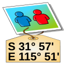
GPS Correlate adds geographic coordinates to photographs after they have been taken. Rather than depending on a camera with a built-in receiver, it compares the time recorded for each image against a track log captured by a separate GPS device, then writes the matching position into the image metadata.
The process assumes two inputs: pictures carrying usable timestamps, and a track log that covers the same span of time. When a photo falls between two logged points, the position has to be worked out from the surrounding record, so the outcome depends on how densely the track was sampled and on the camera clock agreeing with the receiver's time. Once the coordinates are written, they stay with the file and can be read later by image viewers, cataloguing software, and mapping tools.
The program is published by Daniel Fandrich under the GPL-2.0-or-later licence and is packaged for Linux, so it fits photo workflows on that platform and not on others.
Nơi tải về
Linux
- Mở trên FlathubMở trong tab mớiKho góiFlathub
Từ nhà phát hành
Cài bằng dòng lệnh
flatpak install flathub io.github.dfandrich.gpscorrelate
Chúng tôi không lưu trữ tệp này, không quét tệp và không mở tệp ra xem. Hãy đọc những gì nguồn công bố rồi tự quyết định.