번역이 완료되지 않아 이 페이지의 일부는 작성된 원래 언어로 표시됩니다.
주요 사항
- 기존 이미지 파일에 GPS 좌표를 기록합니다.
- 사진 타임스탬프를 별도로 기록된 트랙 로그와 일치시킵니다.
- 통합 GPS 수신기가 있는 카메라의 필요성을 없애줍니다.
- Linux에서 실행됩니다.
- GPL-2.0-or-later에 따라 배포되었습니다.
이 애플리케이션 소개
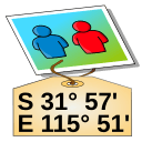
GPS Correlate adds geographic coordinates to photographs after they have been taken. Rather than depending on a camera with a built-in receiver, it compares the time recorded for each image against a track log captured by a separate GPS device, then writes the matching position into the image metadata.
The process assumes two inputs: pictures carrying usable timestamps, and a track log that covers the same span of time. When a photo falls between two logged points, the position has to be worked out from the surrounding record, so the outcome depends on how densely the track was sampled and on the camera clock agreeing with the receiver's time. Once the coordinates are written, they stay with the file and can be read later by image viewers, cataloguing software, and mapping tools.
The program is published by Daniel Fandrich under the GPL-2.0-or-later licence and is packaged for Linux, so it fits photo workflows on that platform and not on others.
받을 수 있는 곳
Linux
- Flathub에서 열기새 탭에서 열림패키지 저장소Flathub
배포처 제공
터미널에서 설치
flatpak install flathub io.github.dfandrich.gpscorrelate
저희는 이 파일을 호스팅하지 않고, 검사하지 않으며, 내용을 확인하지 않습니다. 출처의 설명을 읽고 직접 판단하세요.