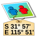
GPS Correlate
Publicado por Daniel Fandrich
Attaches GPS location to images
Partes de esta página aparecen en el idioma en que se escribieron, porque la traducción no está terminada.
Aspectos destacados
- Escribe coordenadas GPS en archivos de imagen existentes.
- Compara las marcas de tiempo de las fotos con un registro de seguimiento grabado por separado.
- Elimina la necesidad de una cámara con un receptor GPS integrado.
- Funciona en Linux.
- Distribuido bajo GPL-2.0-or-later.
Acerca de esta aplicación
GPS Correlate adds geographic coordinates to photographs after they have been taken. Rather than depending on a camera with a built-in receiver, it compares the time recorded for each image against a track log captured by a separate GPS device, then writes the matching position into the image metadata.
The process assumes two inputs: pictures carrying usable timestamps, and a track log that covers the same span of time. When a photo falls between two logged points, the position has to be worked out from the surrounding record, so the outcome depends on how densely the track was sampled and on the camera clock agreeing with the receiver's time. Once the coordinates are written, they stay with the file and can be read later by image viewers, cataloguing software, and mapping tools.
The program is published by Daniel Fandrich under the GPL-2.0-or-later licence and is packaged for Linux, so it fits photo workflows on that platform and not on others.
Dónde obtenerlo
Linux
- Abrir en FlathubSe abre en una pestaña nuevaRepositorio de paquetesFlathub
Del editor
Instalar desde una terminal
flatpak install flathub io.github.dfandrich.gpscorrelate
No alojamos este archivo, no lo analizamos ni inspeccionamos su contenido. Lea lo que indica la fuente y decida por su cuenta.